Rožaje
 |
As of 2011, the city has a population of 9,567 inhabitants.
Surrounded by hills to its west and mountains to its east (notably Mount Hajla), the town is divided in half by, and contains the source of the river Ibar, which gives its name to the local sports clubs FK Ibar, KK Ibar and OK Ibar. Rožaje is the centre of the Rožaje Municipality within the 24 municipalities of Montenegro.
Rožaje annually celebrates its foundation day on September 30.
Rožaje was first settled in antiquity by the Illyrians. Evidence of this Illyrian settlement is located on Brezojevica Hill. Later, during the migration of the Slavs, Slavs settled in the area. Rožaje was first mentioned in 1571 and 1585. The settlement surrounding the then fort was called Trgovište, which it was called until 1912.
During the Ottoman Empire's reign over Montenegro, the Sultan Murat II Mosque was constructed in the city in the 1500s, which also contains the turbe of the sultan's body. It is considered to be the oldest mosque in the entire city.
In 1700, after the Great Serb Migration, the Albanian clans of the Kelmendi and Kuçi and other tribes like the Shkreli of Rugova established themselves in the region of Rožaje and the neighboring town of Tutin in Serbia. The Shala, Krasniqi, and Gashi also moved in the region.
In 1797, the Ganić kula, a defensive tower was built from the Muslim side of the Kuči, as they supported the Muslim authority and cultural practices, was built. Nowadays, the tower is currently the town's museum.
During World War I, the army of the Kingdom of Montenegro captured the city in 1912 from the Ottoman Empire, during the First Balkan War. Within this time, the Montenegrin Army under King Nikola quickly sought to Serbianize the population, to reduce threats of invasions or uprisings by the Albanian locals. It was officially ceded to Montenegro following the Treaty of London in 1913 that ended the war. In 1917, the local Albanian qadi Bajram Balota organised a force of irregulars in the territory held by Austria-Hungary in Montenegro around Berane and Rožaje, with his soldiers and allies persecuting and killing Orthodox Montenegrins. His movement was dissolved following a defeat by Austro-Hungarian soldiers on June 18th, 1918. In 1919, after the war, Rožaje was one of the main cities that participated in an Albanian revolt, which later came to be known as the Plav Rebellion (Montenegrin: Plavskog Pobuna), rising up together with the Plav and Gusinje districts and fighting against the inclusion of Sandzak in the Kingdom of Serbs, Croats and Slovenes. An estimated 700 Albanians were killed in Rožaje by the Serbian army when the rebellion was quelled. These events resulted in a large influx of Albanians migrating to Albania.
During World War II, the city has seen conflict between the Yugoslav Partisans, the Chetniks, the Sandžak Muslim Militia, and the Albanian Vulnetari. Mullah Jakup Kardović, who would end up being a prominent commander of the Militia and would participate in the Battle for Novi Pazar, came from the village of Biševo, which is 4–5km away from the city.
Map - Rožaje
Map
Country - Montenegro
 |
 |
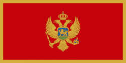
| Flag of Montenegro | |
During the Early Medieval period, three principalities were located on the territory of modern-day Montenegro: Duklja, roughly corresponding to the southern half; Travunia, the west; and Rascia proper, the north. The Principality of Zeta emerged in the 14th and 15th centuries. From the late 14th century to the late 18th century, large parts of southern Montenegro were ruled by the Venetian Republic and incorporated into Venetian Albania. The name Montenegro was first used to refer to the country in the late 15th century. After falling under Ottoman Empire rule, Montenegro gained its semi-autonomy in 1696 under the rule of the House of Petrović-Njegoš, first as a theocracy and later as a secular principality. Montenegro's independence was recognised by the Great Powers at the Congress of Berlin in 1878. In 1910, the country became a kingdom.
Currency / Language
| ISO | Currency | Symbol | Significant figures |
|---|---|---|---|
| EUR | Euro | € | 2 |
| ISO | Language |
|---|---|
| SQ | Albanian language |
| BS | Bosnian language |
| HR | Croatian language |
| HU | Hungarian language |
| SR | Serbian language |


